
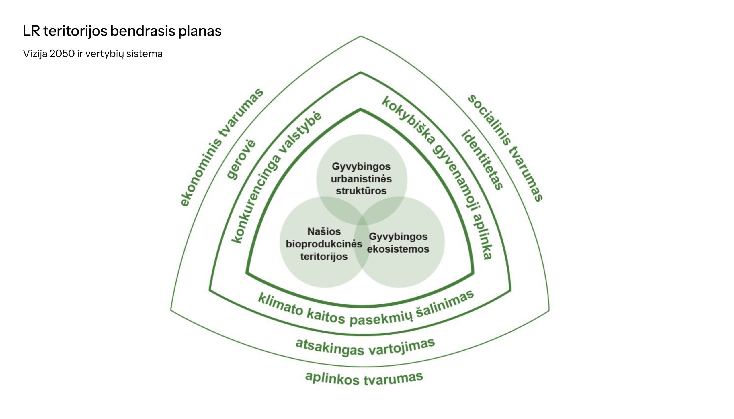

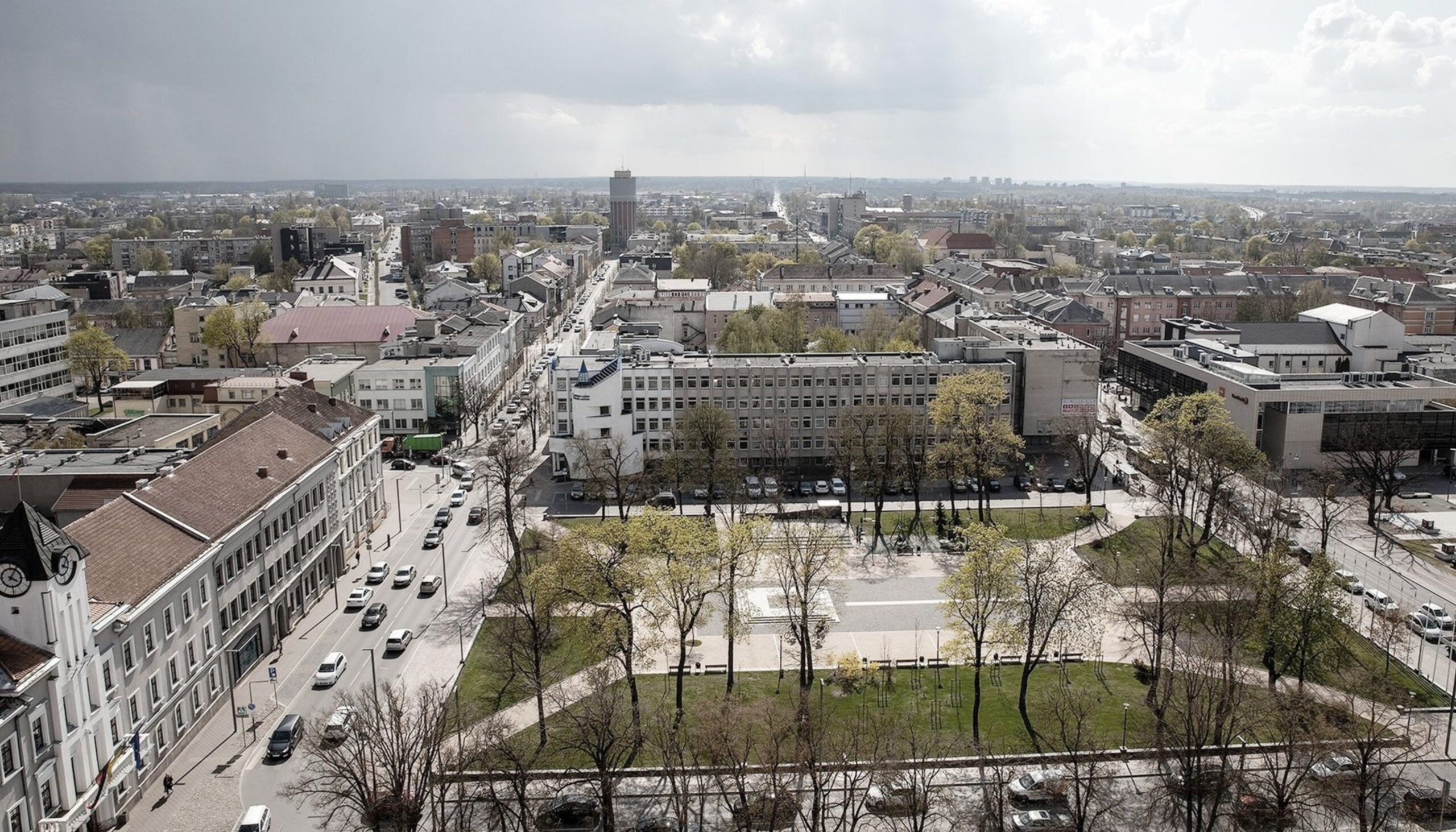


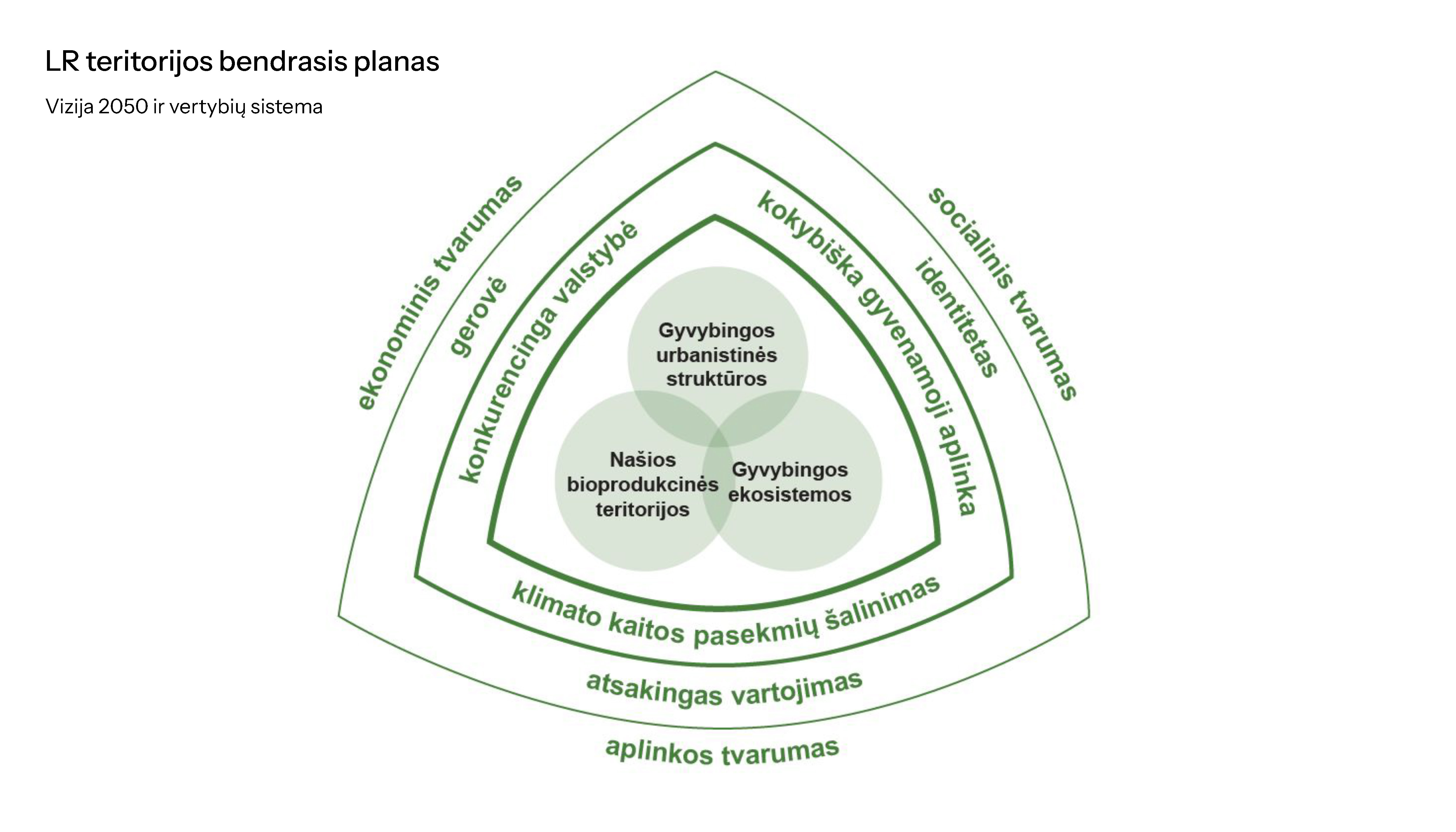


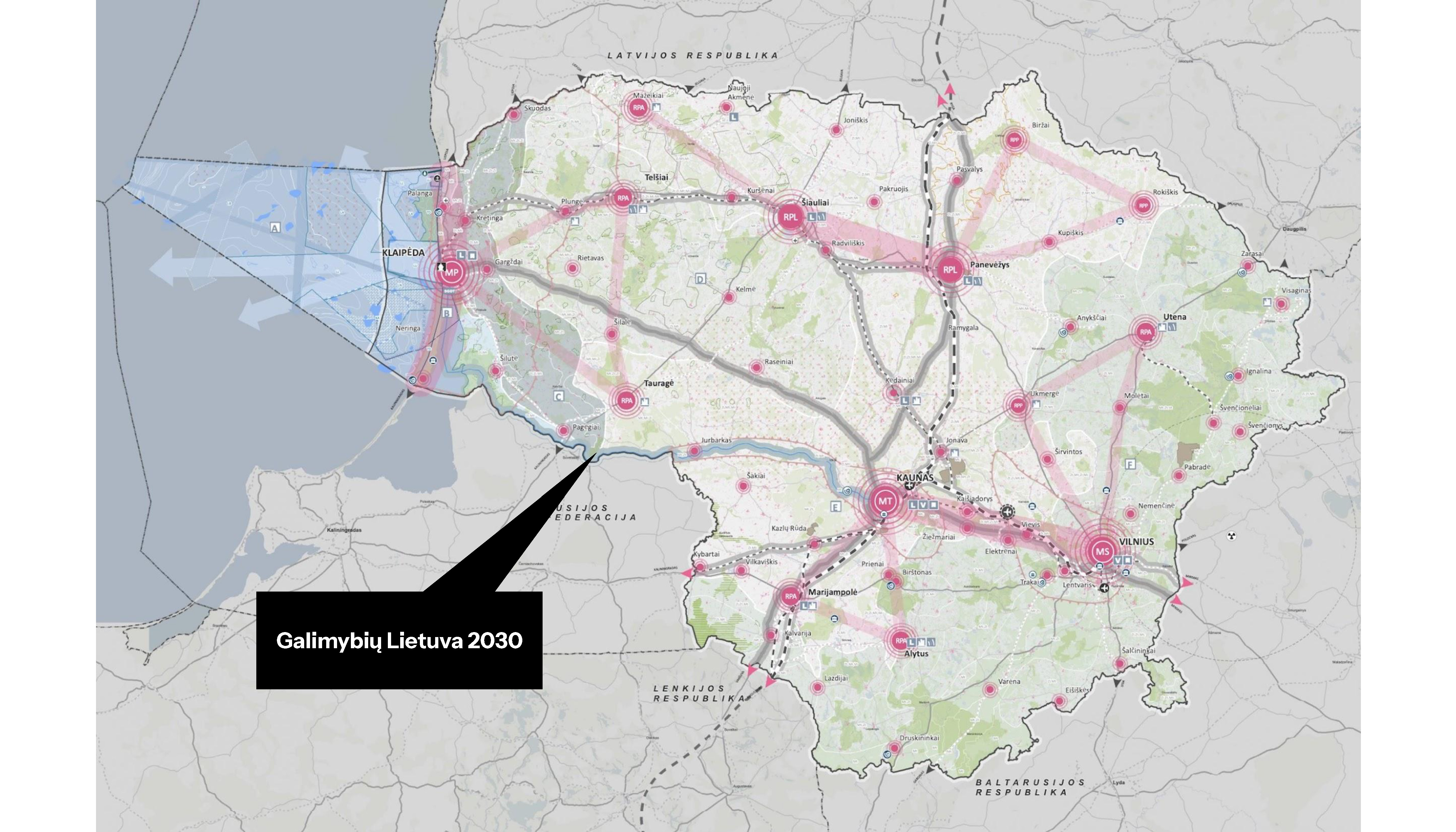
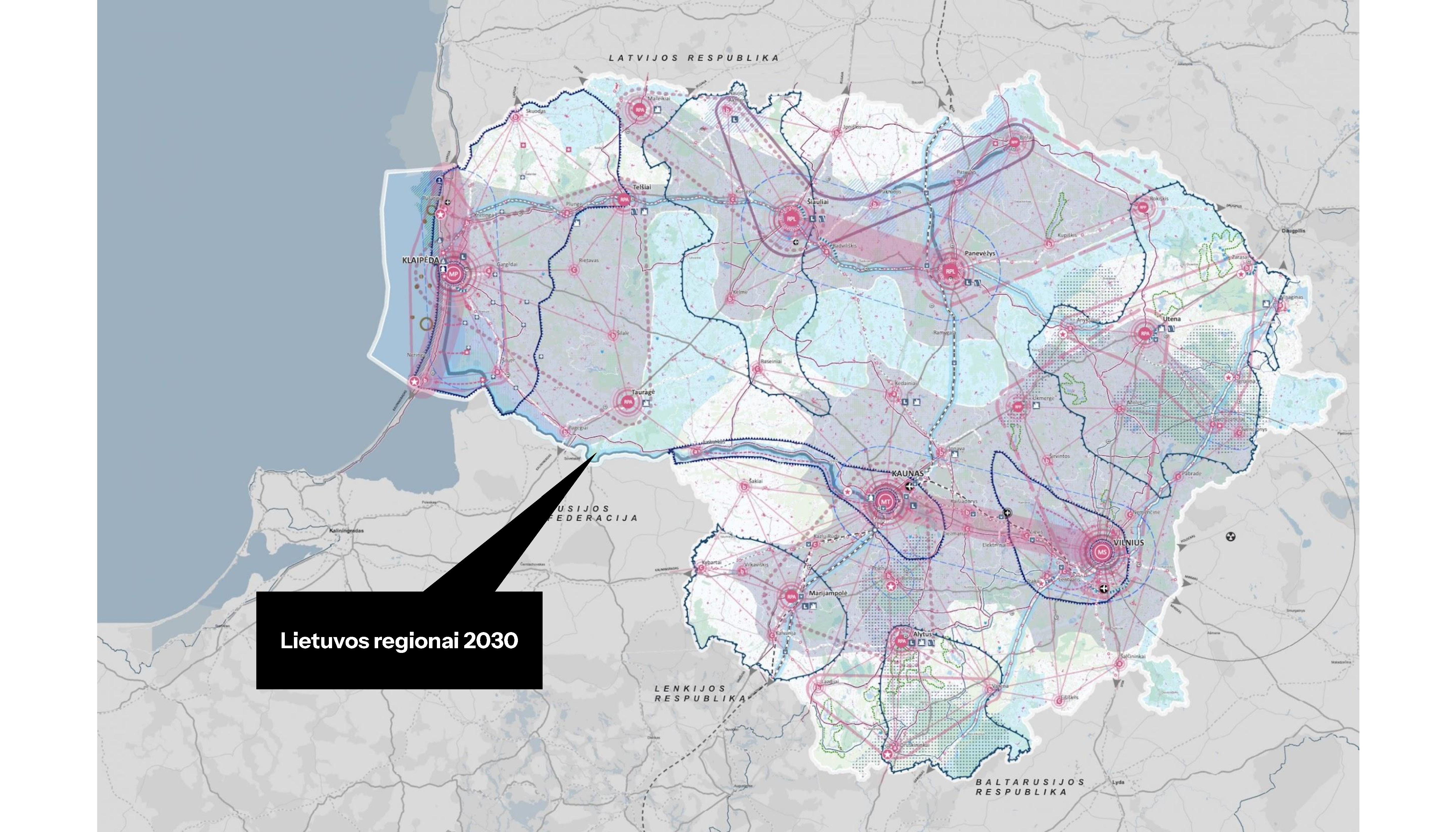


The Comprehensive Plan of the Territory of the Republic of Lithuania is the main integrated strategic document of the country, setting the long-term territorial development perspective until 2050, while its specified solutions stage, encompassing principles for urbanized areas and development strategies, is planned until 2030.
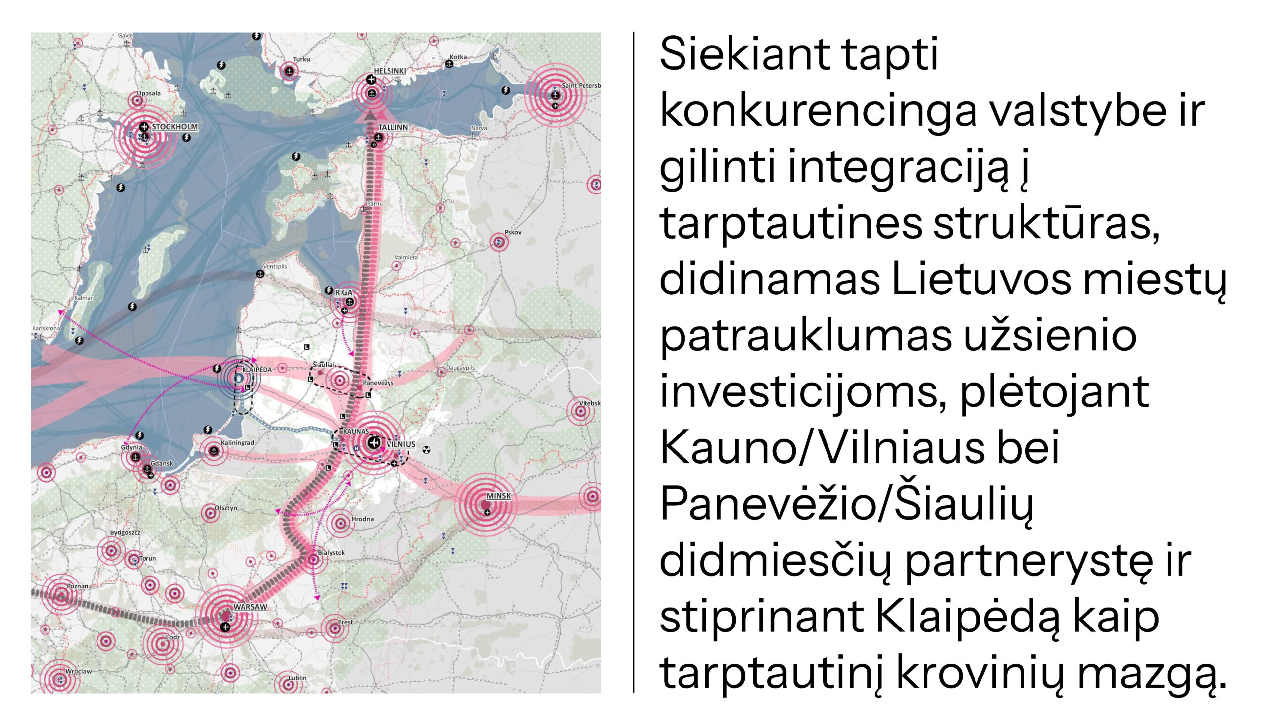
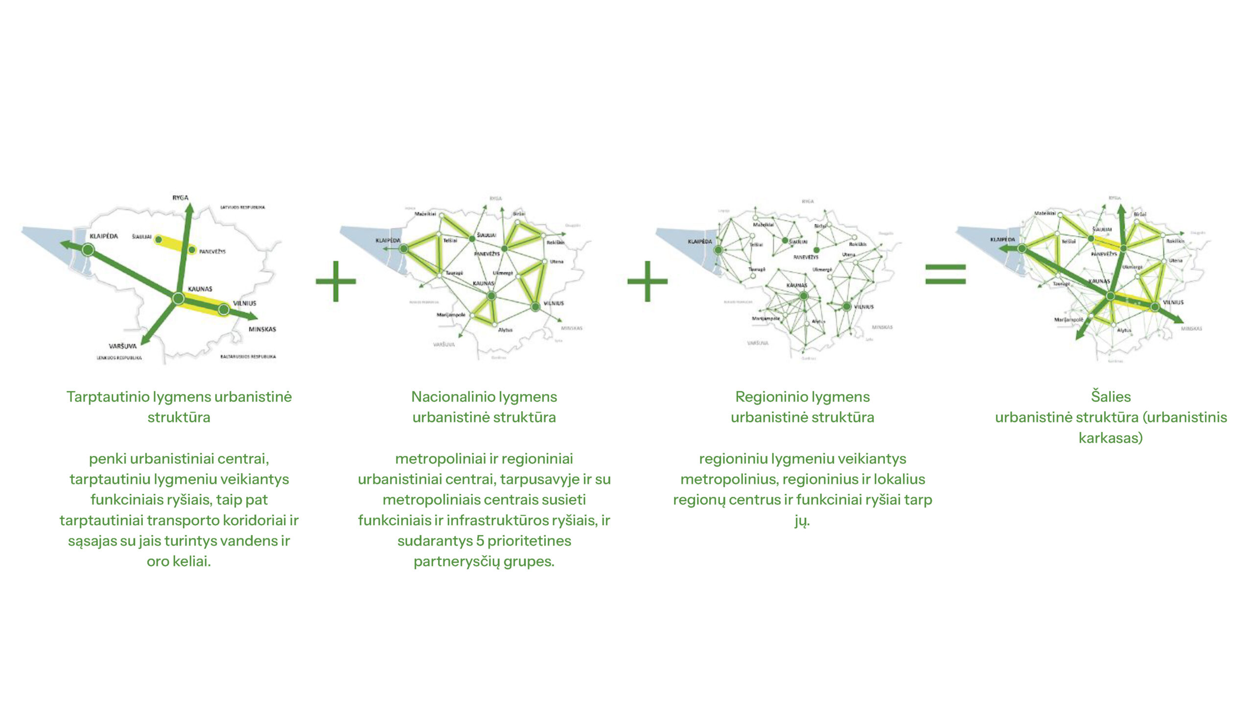
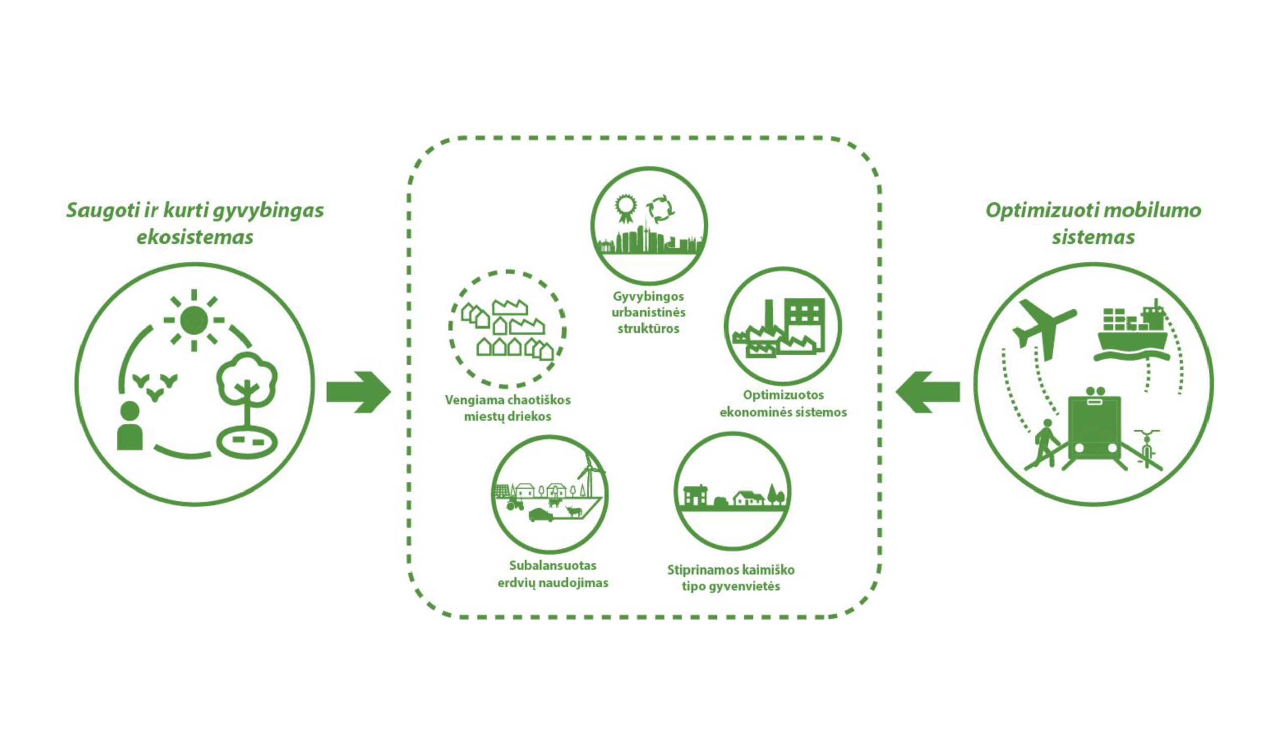
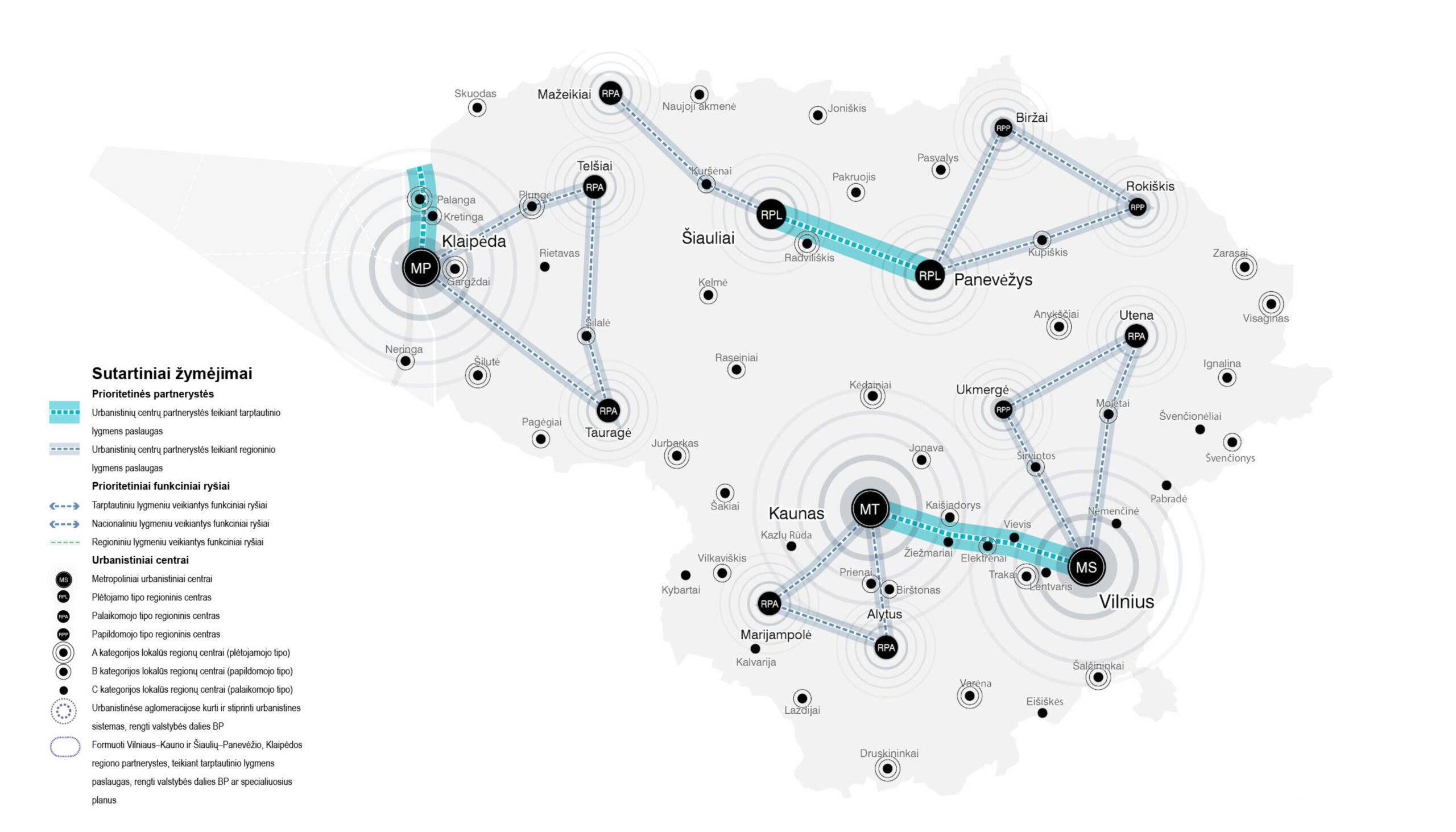
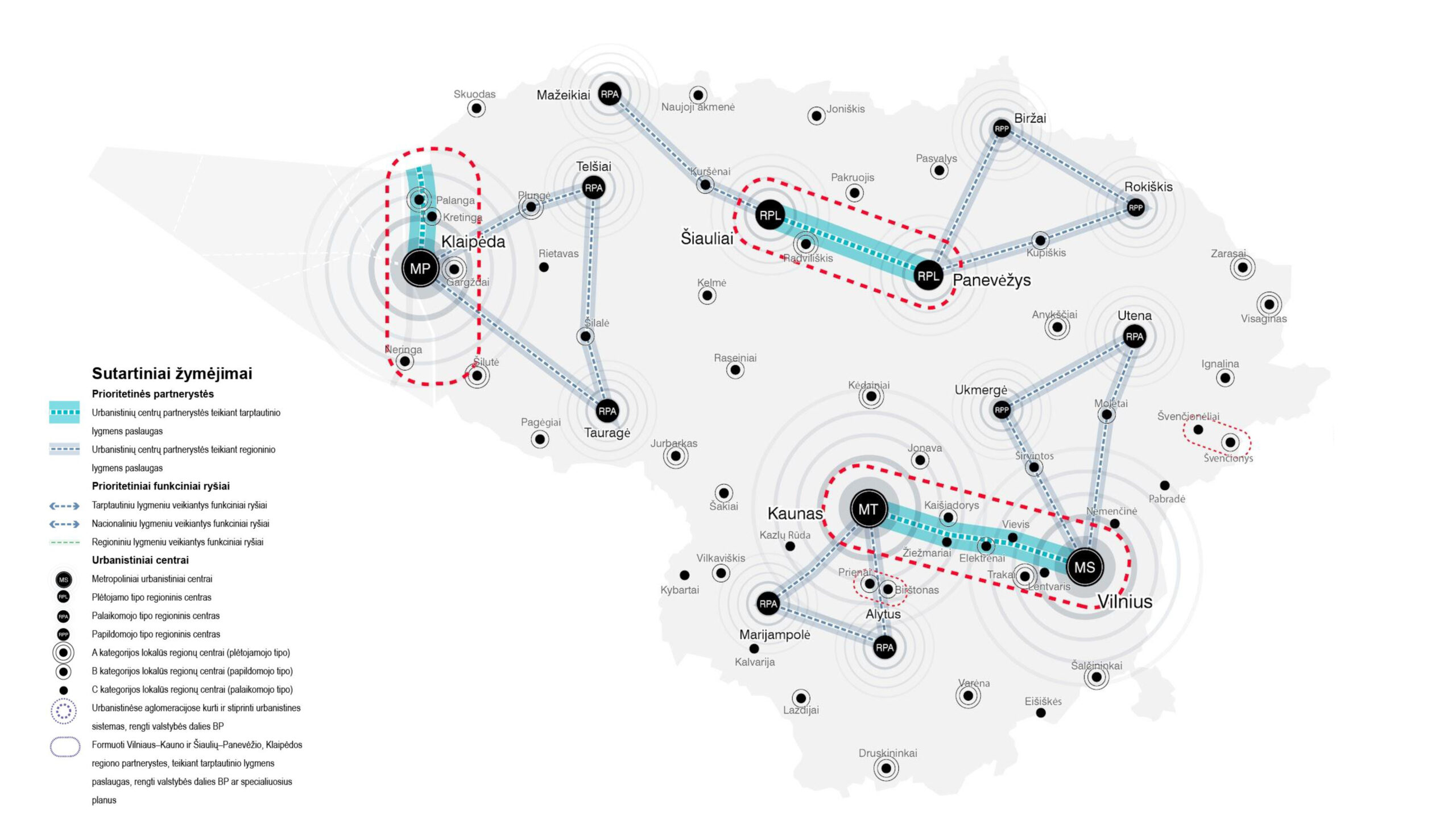
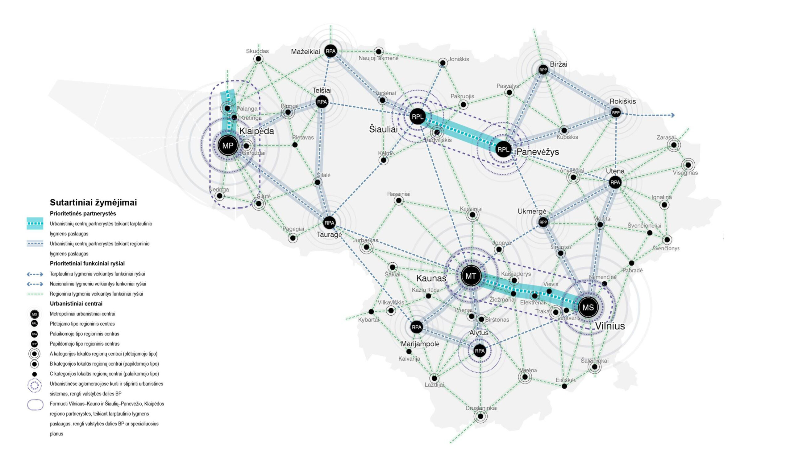
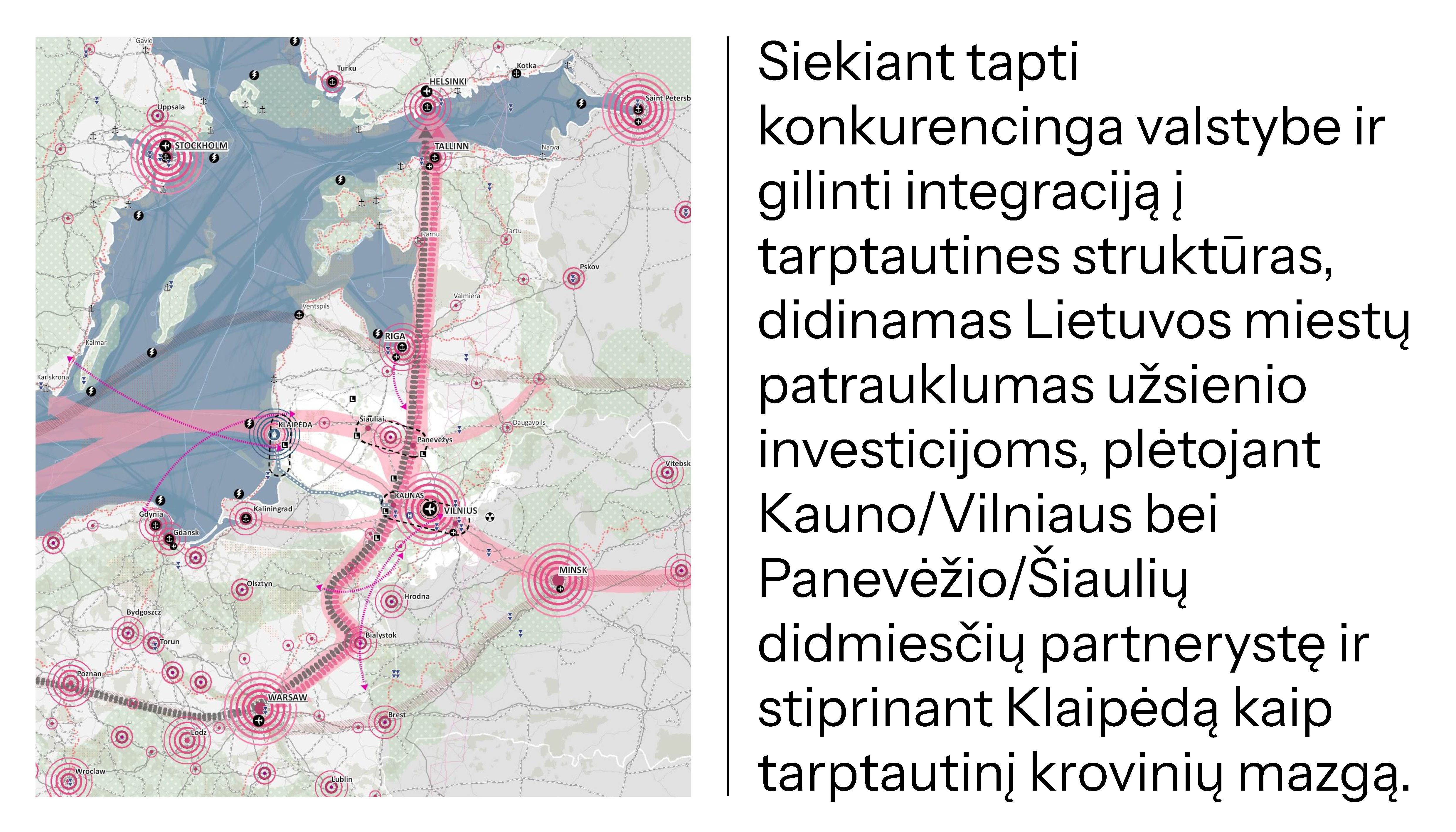
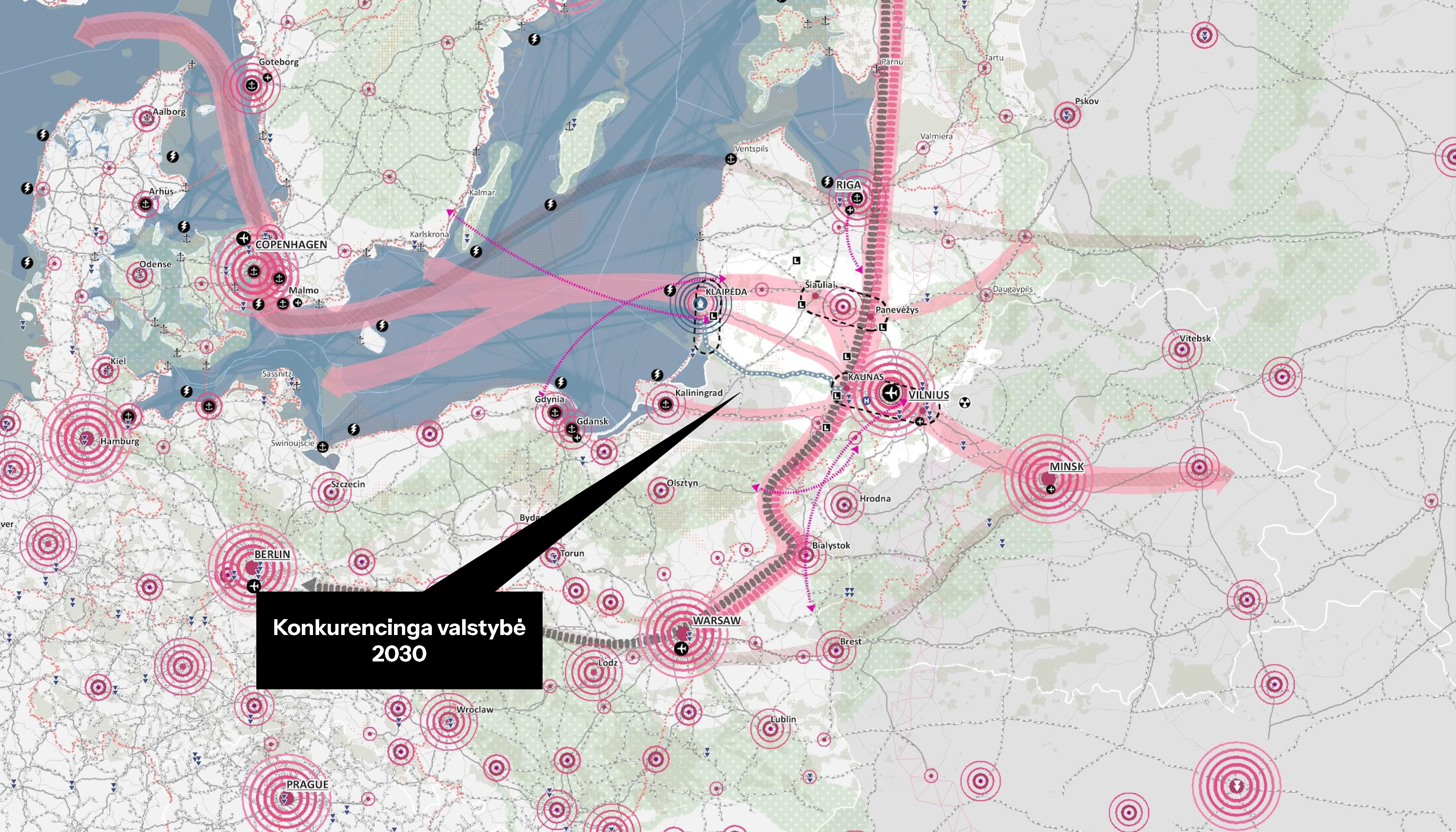
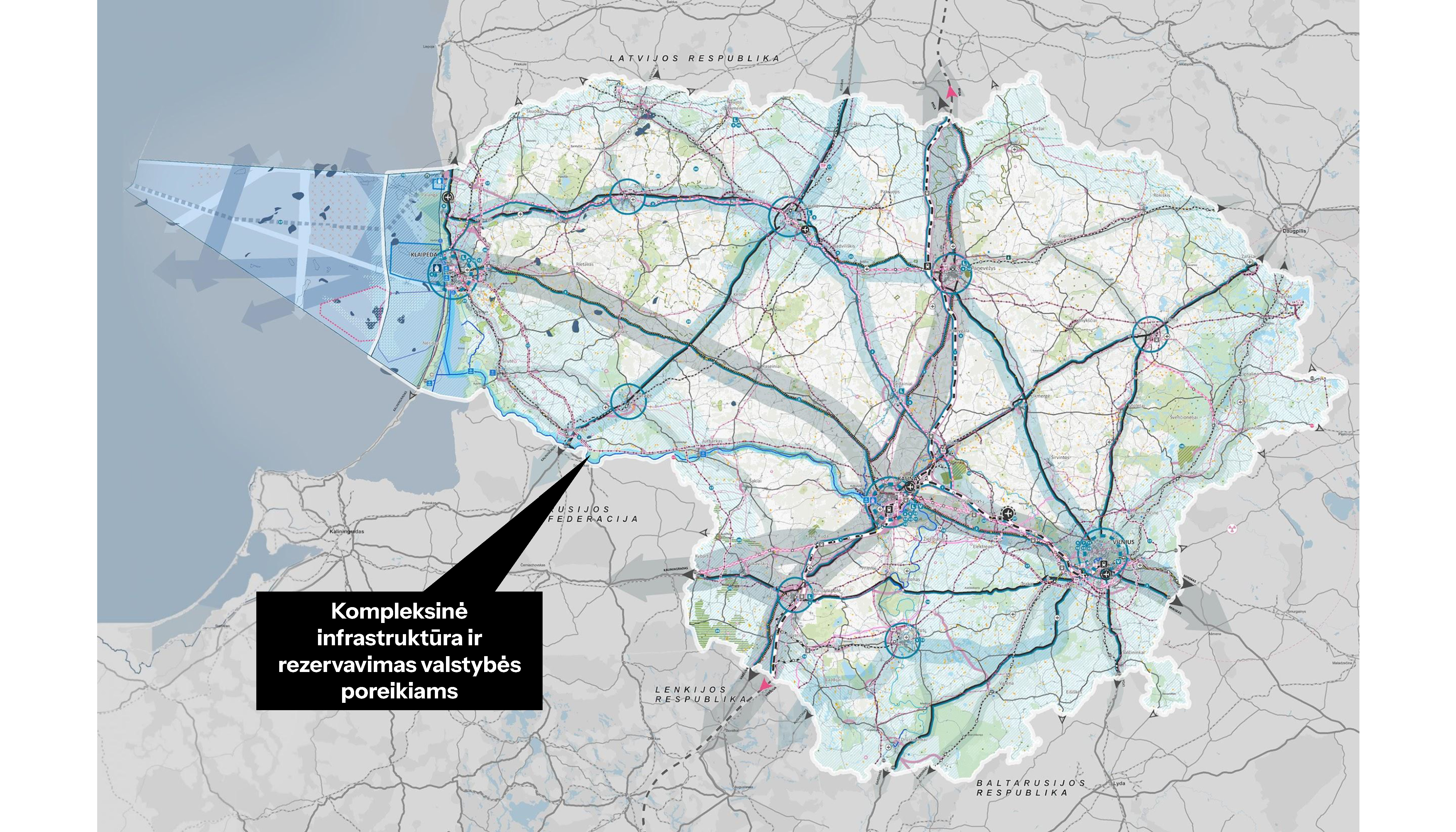
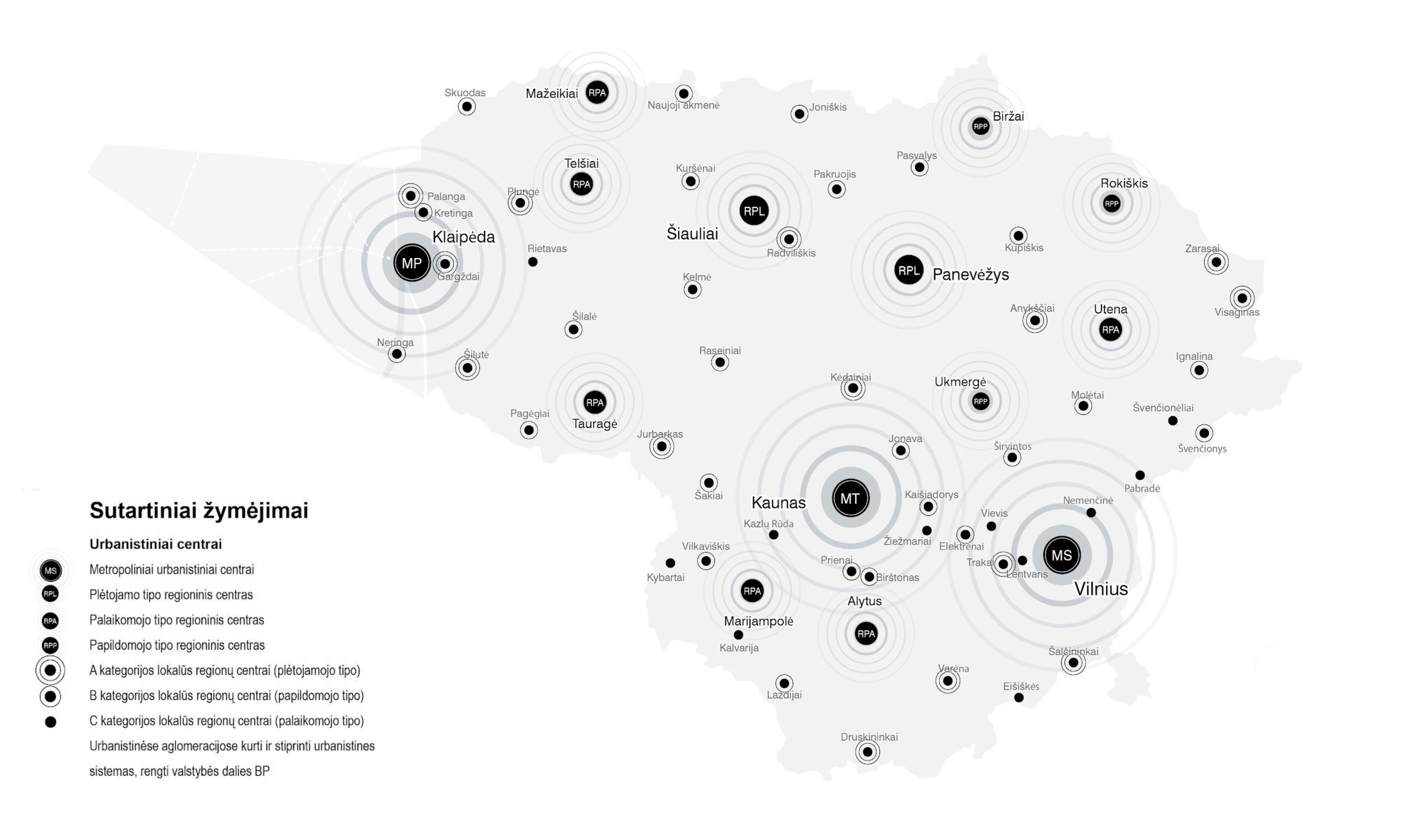
The essence of the Comprehensive Plan of the Territory of the Republic of Lithuania is to create a sustainable and competitive urban system, understood as a network of residential areas linked by functional relationships, which would ensure a high quality of life and reduce regional disparities. This system is based on a hierarchical polycentric structure that divides urban centers into four levels: metropolitan centers of international level, important regional centers, regional local centers that support regional viability, and local centers that concentrate essential services.
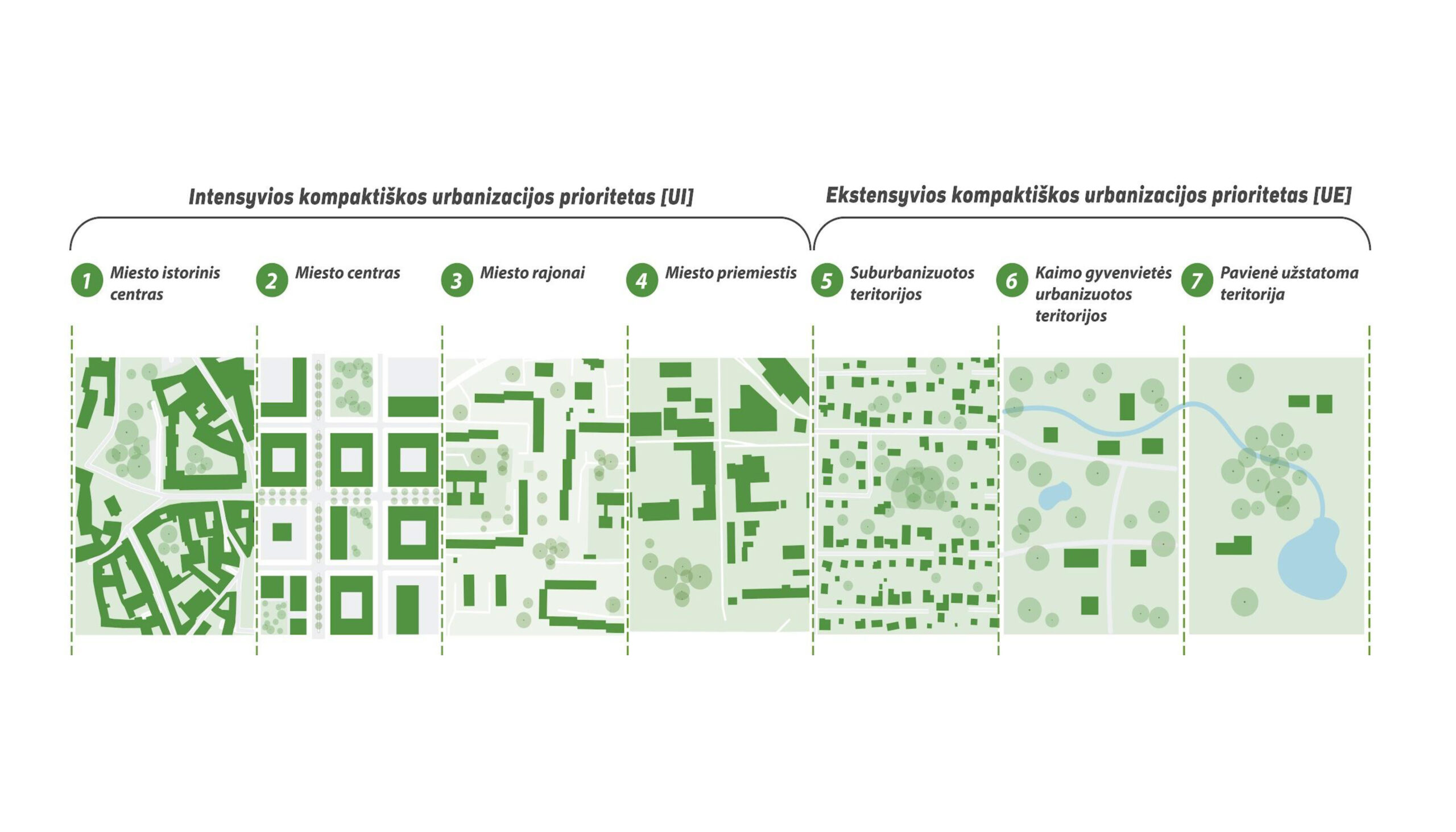
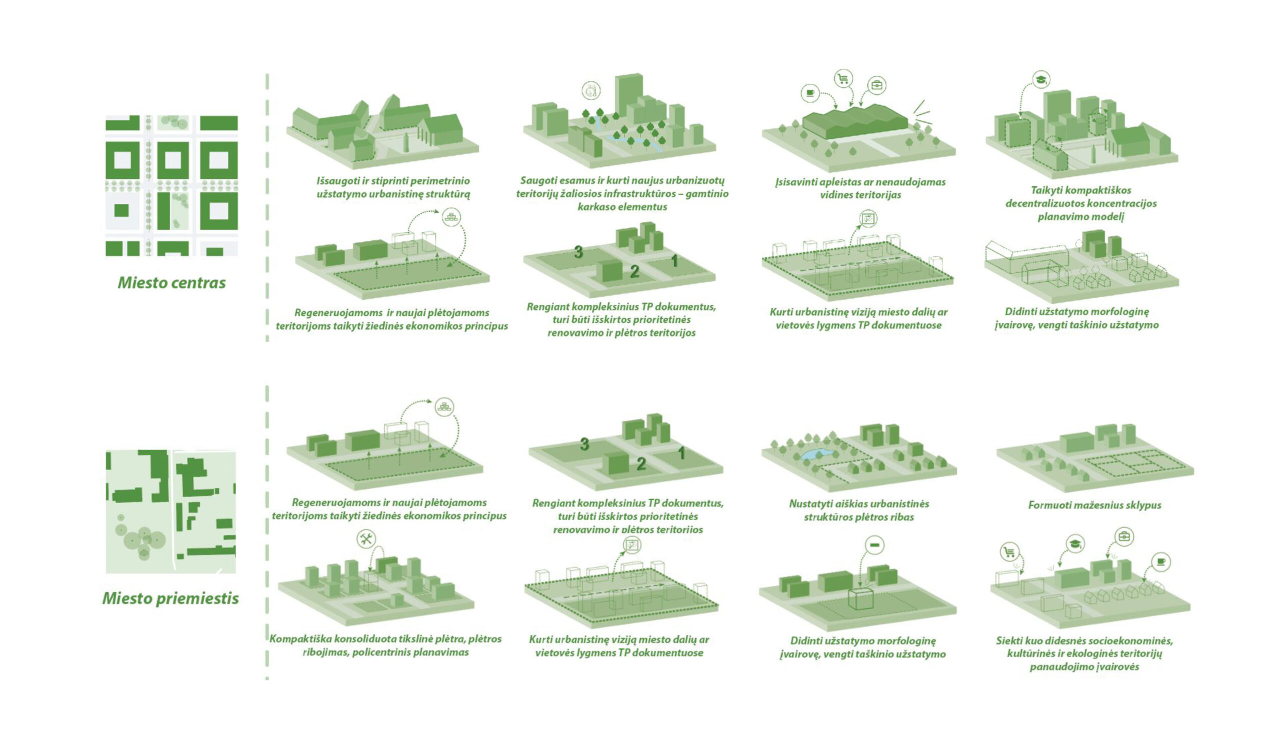
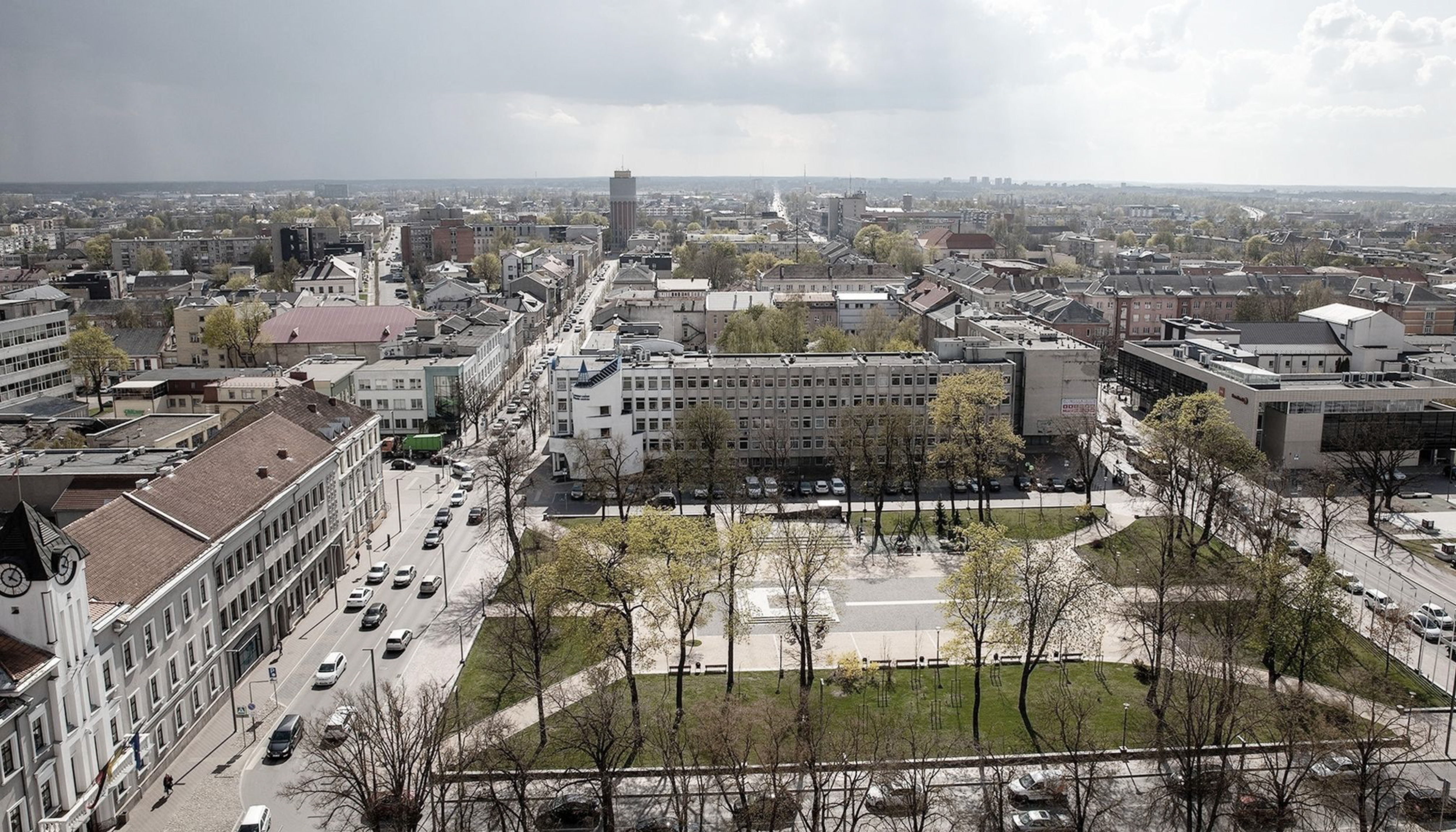
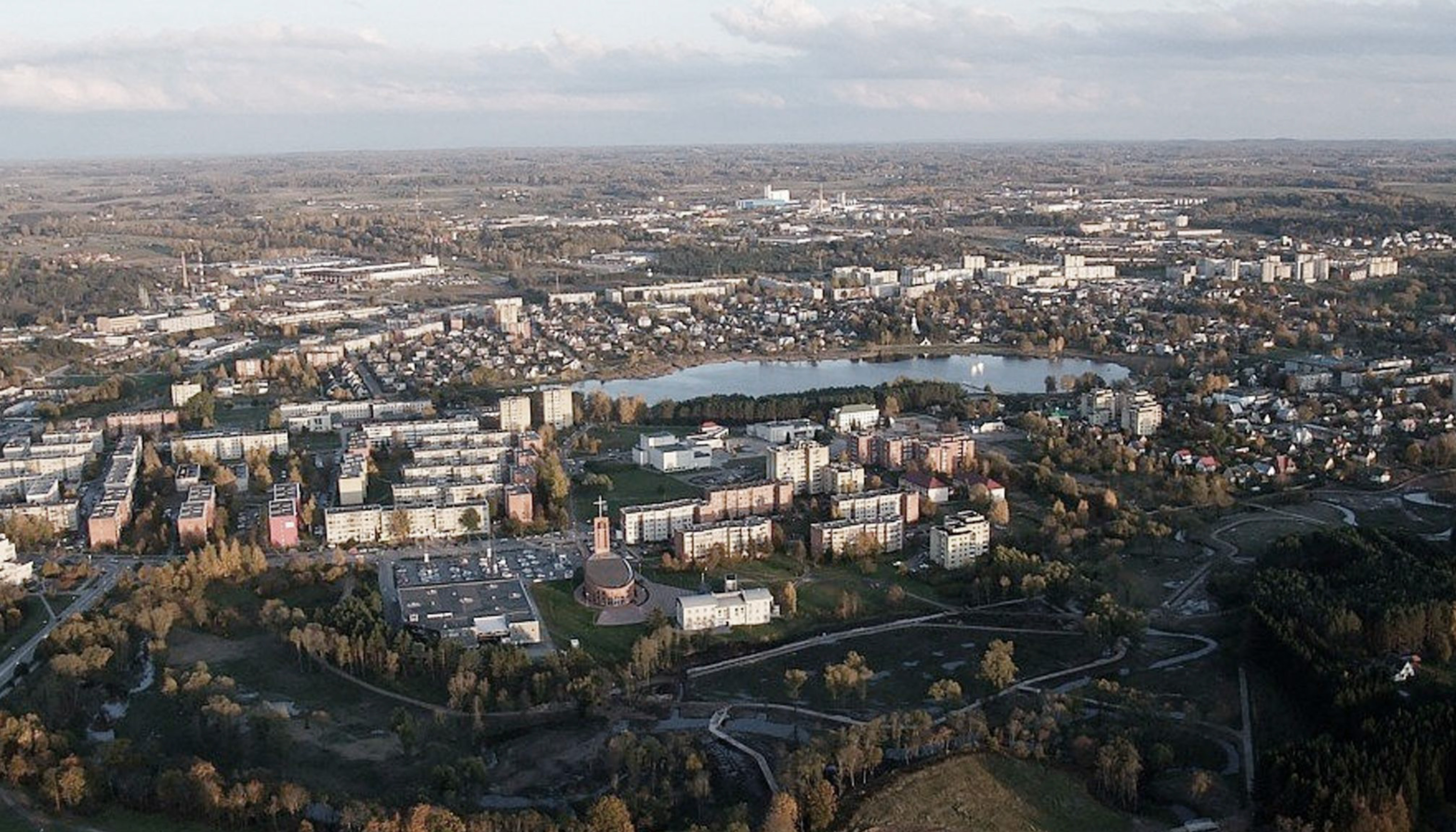
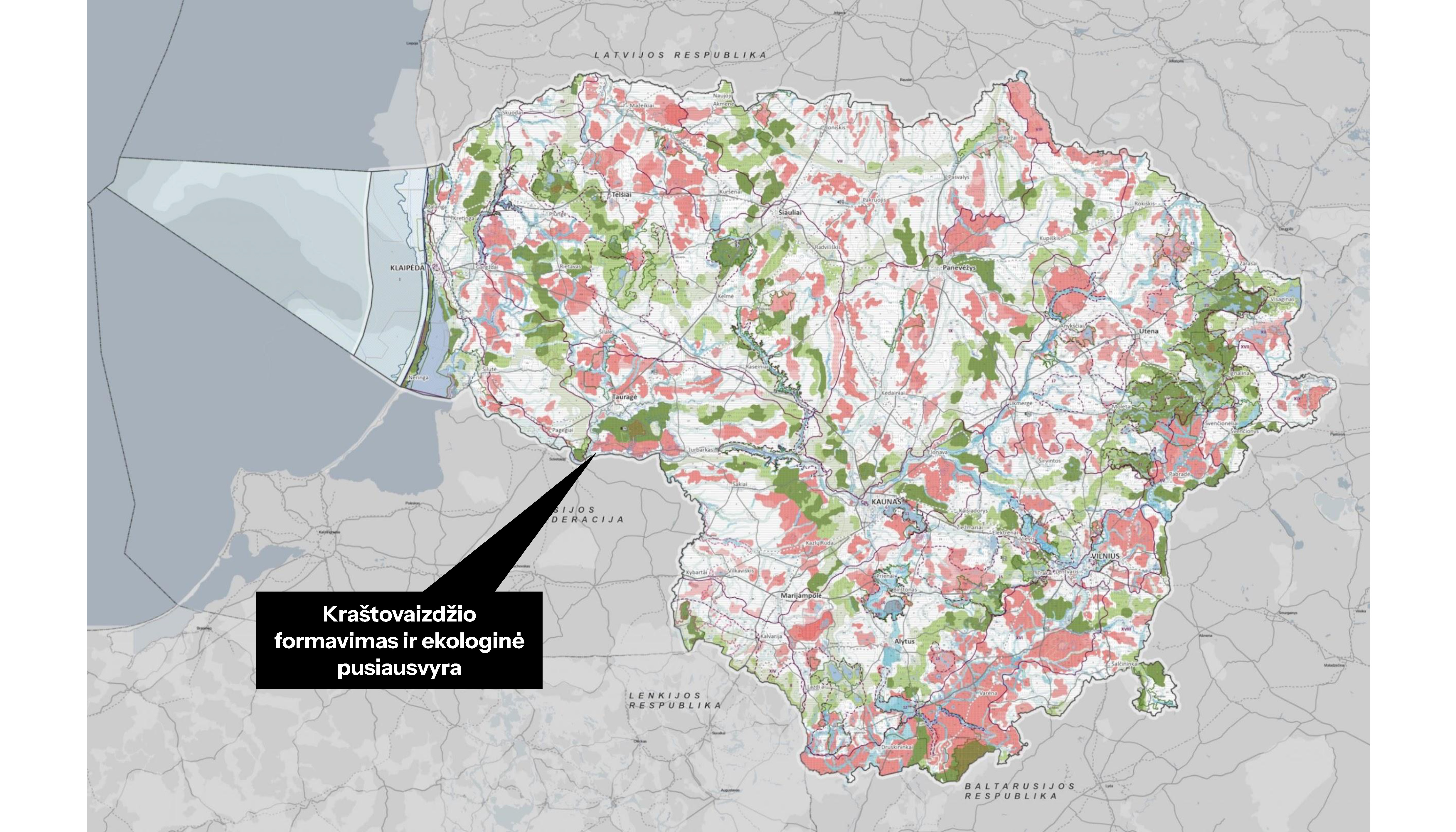
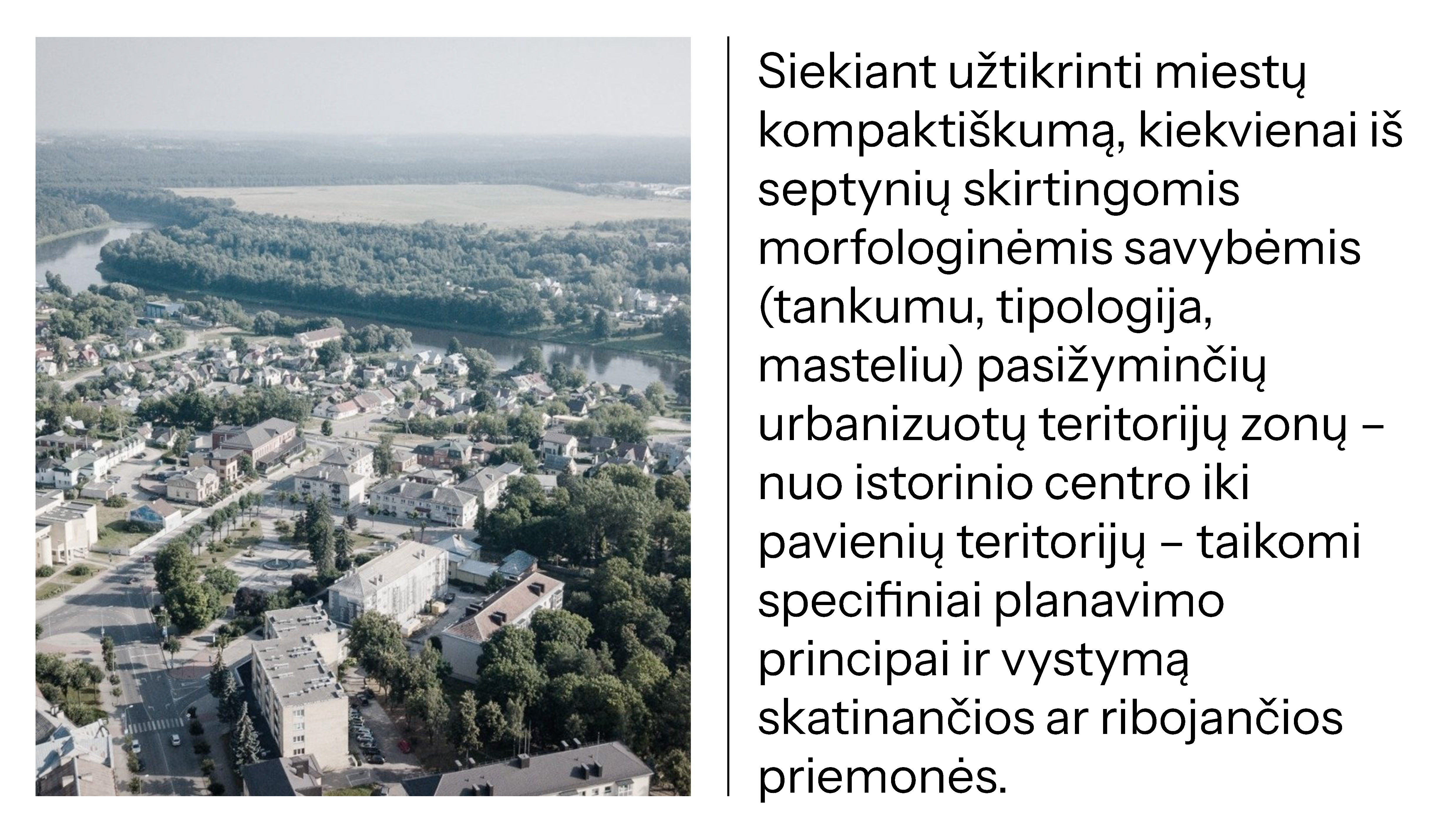
To implement this structure, all territories are divided into intensive or extensive urbanization priority zones, helping to distinguish real urban areas from suburbs or single homesteads. For each territory type (morphotype), such as a historic center or a suburb, a special morphotypological table and an adapted set of compact city development tools are applied – from public-private partnership models for regeneration to specific promotion or restriction tools.
Location
Lithuania
Year
2020 – 2021
Client
Ministry of Environment of the Republic of Lithuania
Team
Donatas Baltrušaitis
Paulius Kliučininkas
Matas Olendra
Collaborators
Bauland, Civitta, Plentprojektas, Xwhy, Atkulos projektai